Welcome to my Research Areas section. My work bridges law, public health, and data science to address violence, trauma, and health disparities, with a focus on historically marginalized communities. I integrate geospatial analysis, advanced statistics, and community-engaged research to inform prevention and policy change.
Thematic Areas
-
Adverse Childhood Experiences (ACEs)
Investigating how childhood trauma, neglect, and structural adversity contribute to long-term health, development, and justice outcomes.
-
Community-Based Violence
Studying the structural and environmental determinants of gun violence and neighborhood-level risk to inform place-based prevention.
-
Intimate Partner & Domestic Violence
Examining the health and justice impacts of IPV during pregnancy and across the life course, with attention to structural risk factors.
-
Substance Use & Overdose
Analyzing social, spatial, and policy drivers of opioid overdose and other substance-related harms, with emphasis on service access.
-
Suicide Prevention
Modeling how environmental, social, and health inequities intersect to shape suicide risk, with a focus on geographic and structural influences.
Focal Populations
-
Sexual and Gender Minorities
Addressing violence, health disparities, and structural inequities affecting LGBTQ+ populations.
-
Minoritized Communities
Centering research on racially and ethnically marginalized groups disproportionately impacted by violence and health inequities.
-
Youth
Focusing on developmental risk, adversity, and justice system involvement among young people.
-
Older Individuals
Exploring intersections of aging, disability, and structural vulnerability, including violence and access to care.
-
People with Disabilities
Investigating how social determinants and systemic barriers contribute to violence, neglect, and health disparities.
-
People Who Use Drugs
Examining the interplay of substance use, social marginalization, and structural risk in shaping health outcomes.
Methodological Expertise
-
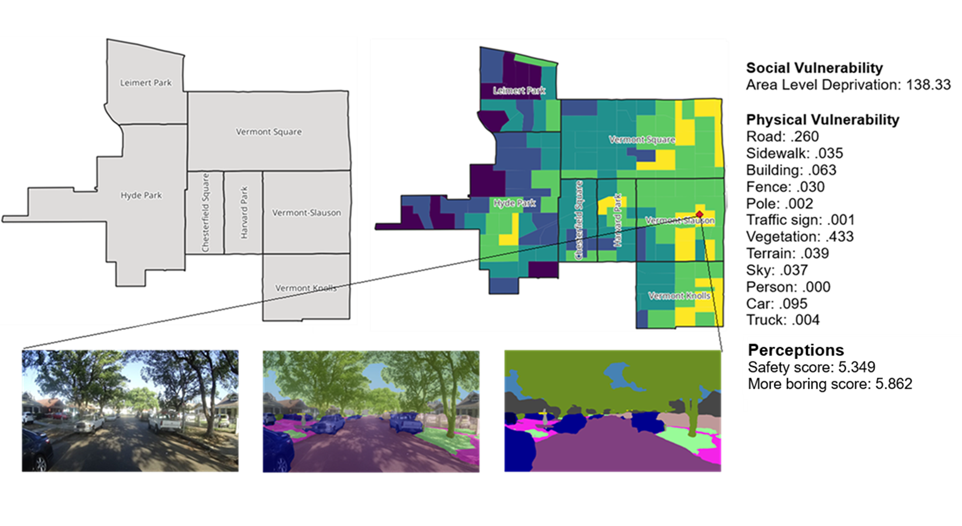
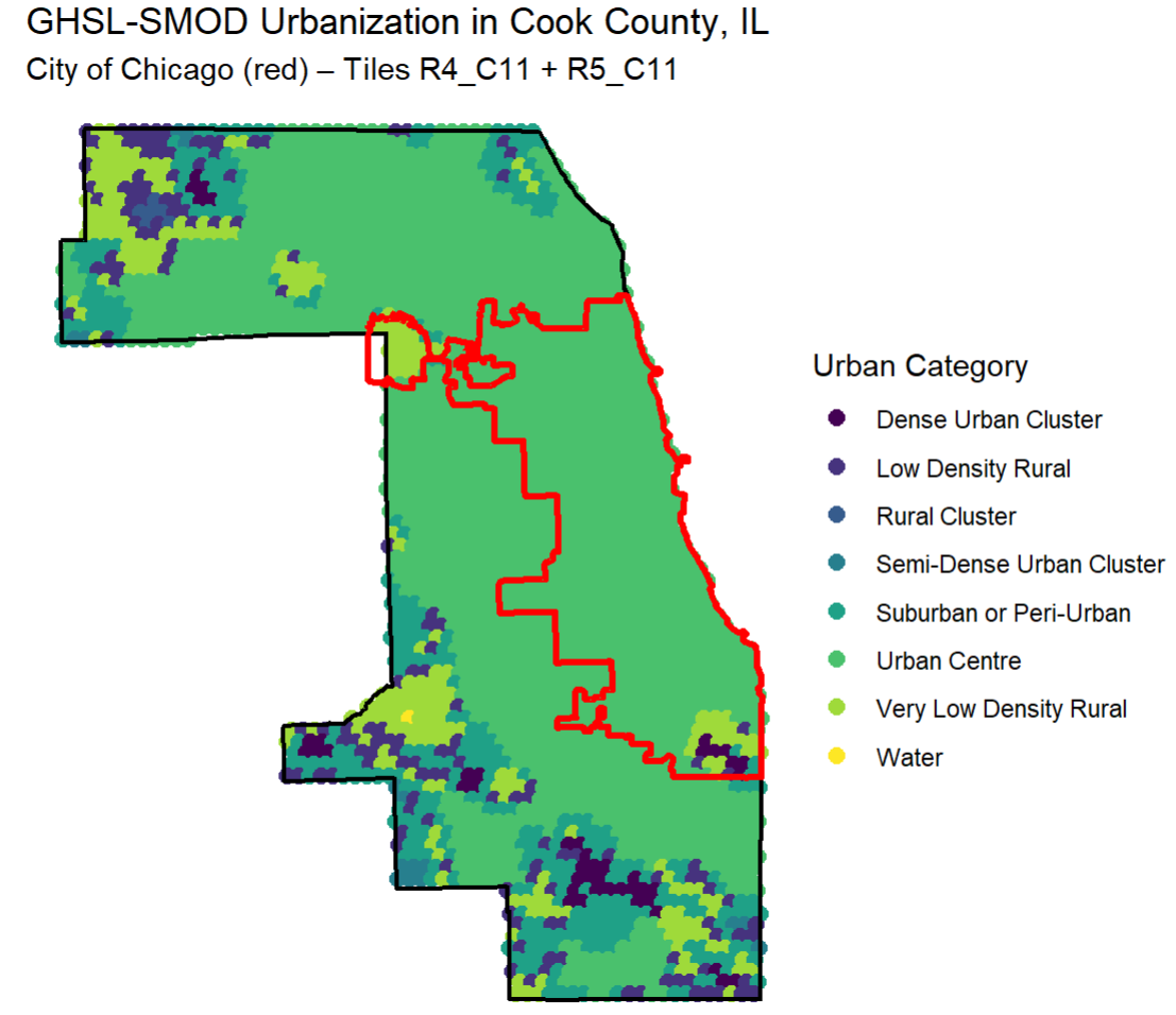
Spatial Analysis & GIS
Mapping neighborhood-level risk, structural inequities, and spatial patterns of violence and health outcomes.
-
Bayesian & Advanced Statistical Modeling
Applying spatial Bayesian models, multilevel analysis, and predictive modeling to complex social and health issues.
-
Machine Learning & Data Science
Using machine learning tools, including spatial random forests and AI-driven geospatial analysis, to identify risk patterns and prevention opportunities.
-
Community-Based & Participatory Research
Integrating community perspectives and lived experience into research design, analysis, and policy translation.
-
Forensic & Legal Geography
Applying spatial methods to legal investigations and expert witness work focused on structural injustice and environmental harm.
Current Projects
-
The ISSUE Lab
Founder and Director of the Investigating Spatial Structures in Urban Environments (ISSUE) Lab, using geospatial data science to inform violence prevention and environmental justice efforts.
-
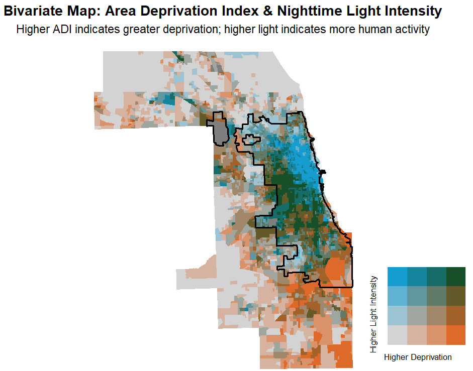
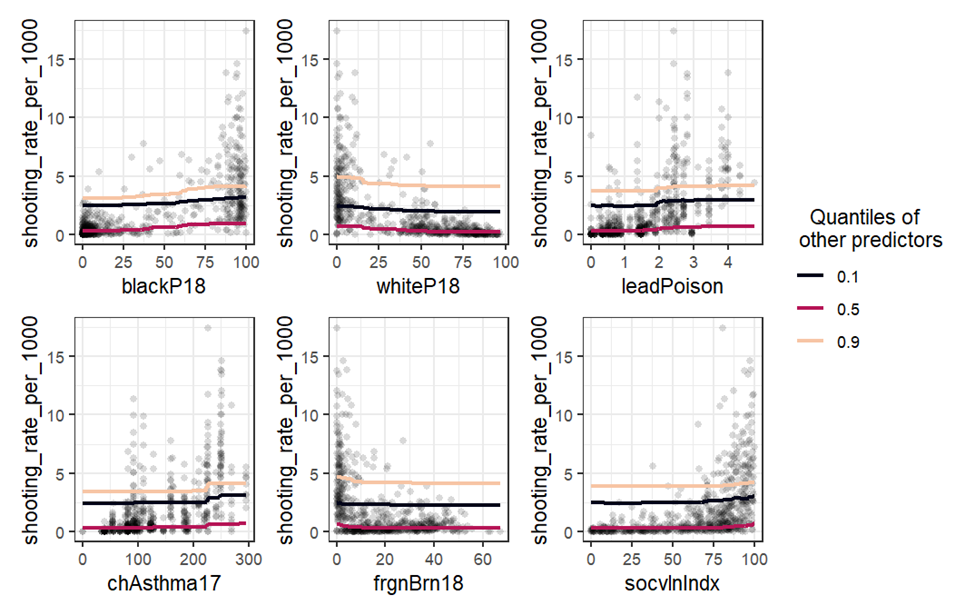
Gun Violence and Structural Inequities in Chicago
Leading a multi-method spatial analysis of neighborhood predictors of non-fatal firearm injury using spatial random forests and Bayesian models.
-
Opioid Overdose and Environmental Risk in Cook County
Investigating how green space, urban form, and structural disadvantage shape overdose mortality through spatial modeling.
-
Structural Mitigation in Capital Defense
Developing expert witness materials that integrate forensic geography and systemic risk analysis to contextualize legal outcomes in death penalty cases.
-
Suicide, Green Space, and Environmental Inequities
Analyzing the intersection of environmental exposures, structural vulnerability, and suicide risk using spatial Bayesian approaches.